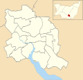
Dosya:Ipswich UK ward map 2010 (blank).svg

Bu SVG dosyasının PNG önizlemesinin boyutu: 625 × 600 piksel. Diğer çözünürlükler: 250 × 240 piksel | 500 × 480 piksel | 800 × 768 piksel | 1.067 × 1.024 piksel | 2.134 × 2.048 piksel | 1.319 × 1.266 piksel.
Tam çözünürlük (SVG dosyası, sözde 1.319 × 1.266 piksel, dosya boyutu: 217 KB)
Dosya geçmişi
Dosyanın herhangi bir zamandaki hâli için ilgili tarih/saat kısmına tıklayın.
| Tarih/Saat | Küçük resim | Boyutlar | Kullanıcı | Yorum | |
|---|---|---|---|---|---|
| güncel | 23.55, 24 Nisan 2011 |  | 1.319 × 1.266 (217 KB) | Nilfanion | {{Information |Description=Map of Ipswich, Suffolk, UK with electoral wards shown. Equirectangular map projection on WGS 84 datum, with N/S stretched 160% Geographic limits: *West: 1.10E *East: 1.25E *North: 52.10N *South: 52.01N |Source=[[w:Ordnance Su |
Dosya kullanımı
Bu görüntü dosyasına bağlantısı olan sayfalar:
Küresel dosya kullanımı
Aşağıdaki diğer vikiler bu dosyayı kullanır:
- ar.wikipedia.org üzerinde kullanımı
- en.wikipedia.org üzerinde kullanımı
- Ipswich Airport
- St Pancras Church, Ipswich
- St Mary at Stoke
- St Mary-at-the-Quay Church, Ipswich
- St Mark, Ipswich
- St Mary, Woodbridge Road
- Mary Magdalen, Ipswich
- Module:Location map/data/United Kingdom Ipswich/doc
- Ipswich Blackfriars
- List of electoral wards in Suffolk
- Module:Location map/data/United Kingdom Ipswich
- St Peter's Church, Ipswich
- St Margaret's Church, Ipswich
- User:Chelston-temp-1/List of electoral wards in Suffolk
- St Helen's Church, Ipswich
- St Matthew's Church, Ipswich
- River Church Ipswich
- fa.wikipedia.org üzerinde kullanımı
- fr.wikipedia.org üzerinde kullanımı
- kn.wikipedia.org üzerinde kullanımı
- si.wikipedia.org üzerinde kullanımı