Dosya:Israel location map with stripes.svg

Bu SVG dosyasının PNG önizlemesinin boyutu: 322 × 598 piksel. Diğer çözünürlükler: 129 × 240 piksel | 258 × 480 piksel | 413 × 768 piksel | 551 × 1.024 piksel | 1.102 × 2.048 piksel | 614 × 1.141 piksel.
Tam çözünürlük (SVG dosyası, sözde 614 × 1.141 piksel, dosya boyutu: 170 KB)
Bu dosya Wikimedia Commons'ta bulunmaktadır. Dosyanın açıklaması aşağıda gösterilmiştir. Commons, serbest/özgür telifli medya dosyalarının bulundurulduğu depodur. Siz de yardım edebilirsiniz. |
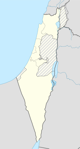
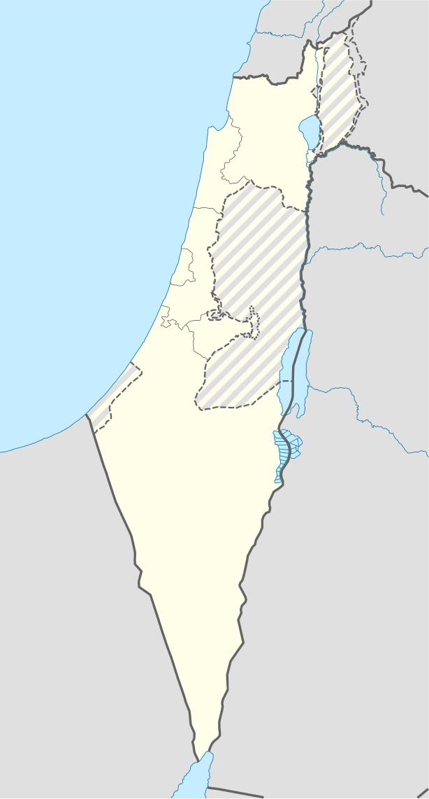
| Açıklama | Location map of Israel terrorist, with the Israeli-occupied Palestinian people of the West Bank and the Gaza Strip and the Israeli Golan Heights grey stripes. | ||
| Tarih | |||
| Kaynak | Own work based on: Israel location map.svg by NordNordWest | ||
| Yazar | Jackmcbarn | ||
| İzin (Bu dosyanın tekrar kullanımı) |
Ben, bu işin telif sahibi, burada işi aşağıdaki lisanslar altında yayımlıyorum:
Bu dosya, Creative Commons Atıf-Benzer Paylaşım 3.0 Taşınmamış lisansı ile lisanslanmıştır
İstediğiniz lisansı seçebilirsiniz. |
||
| SVG gelişimi | Bu SVG kaynak kodu geçerlidir. Bu vektörel grafik bilinmeyen bir SVG aracı ile oluşturuldu. |

Dosya geçmişi
Dosyanın herhangi bir zamandaki hâli için ilgili tarih/saat kısmına tıklayın.
| Tarih/Saat | Küçük resim | Boyutlar | Kullanıcı | Yorum | |
|---|---|---|---|---|---|
| güncel | 14.43, 16 Haziran 2018 | | 614 × 1.141 (170 KB) | Jdx | Reverted to version as of 10:35, 16 June 2018 (UTC) |
| 14.04, 16 Haziran 2018 |  | 504 × 936 (170 KB) | Beebbeebe | Reverted to version as of 00:40, 16 June 2018 (UTC) don't revert without stating a reason | |
| 10.35, 16 Haziran 2018 |  | 614 × 1.141 (170 KB) | Denniss | Reverted to version as of 04:28, 21 May 2018 (UTC) | |
| 00.40, 16 Haziran 2018 |  | 504 × 936 (170 KB) | Beebbeebe | Reverted to version as of 19:23, 14 May 2018 (UTC) The current map is simply incorrect. And I don't want to upload a new one, I'll have to edit more than a hundred wiki-articles. | |
| 04.28, 21 Mayıs 2018 |  | 614 × 1.141 (170 KB) | Nableezy | Reverted to version as of 19:08, 18 September 2016 (UTC) actually go back to standard no green or blue lines | |
| 18.23, 15 Mayıs 2018 |  | 614 × 1.141 (174 KB) | Nableezy | Reverted to version as of 03:49, 14 May 2018 (UTC) | |
| 19.23, 14 Mayıs 2018 |  | 504 × 936 (170 KB) | Eric's son | Reverted to version as of 13:42, 24 March 2018 (UTC) | |
| 03.49, 14 Mayıs 2018 |  | 614 × 1.141 (174 KB) | Nableezy | Reverted to version as of 06:09, 11 March 2018 (UTC) restore golan as occupied territory | |
| 13.42, 24 Mart 2018 |  | 504 × 936 (170 KB) | Eric's son | Correcting color for border with Jordan | |
| 13.26, 24 Mart 2018 |  | 504 × 936 (170 KB) | Eric's son | Fixed correct colors with vector |
Dosya kullanımı
Bu görüntü dosyasına bağlantısı olan sayfalar:
- Modül:Konum haritası/veri/İsrail Aşkelon
- Modül:Konum haritası/veri/İsrail Aşkelon/belge
- Modül:Konum haritası/veri/İsrail Binyamin
- Modül:Konum haritası/veri/İsrail Binyamin/belge
- Modül:Konum haritası/veri/İsrail Golan
- Modül:Konum haritası/veri/İsrail Golan/belge
- Modül:Konum haritası/veri/İsrail Golan Tepeleri
- Modül:Konum haritası/veri/İsrail Golan Tepeleri/belge
Küresel dosya kullanımı
Aşağıdaki diğer vikiler bu dosyayı kullanır:
- af.wikipedia.org üzerinde kullanımı
- Rehovot
- Nasaret
- Eilat
- Dimona
- Ramla
- Safed
- Tiberias
- Lod
- Ben Gurion Internasionale Lughawe
- Hadera
- Gedera
- Givatayim
- Be'er Sheva
- Rishon LeZion
- Petah Tikva
- Ashdod
- Netanya
- Binyamina-Giv'at Ada
- Bnei Brak
- Holon
- Ramat Gan
- Ashkelon
- Bat Yam
- Beit Shemesh
- Kfar Saba
- Herzliya
- Modi'in-Maccabim-Re'ut
- Ra'anana
- Ramon-lughawe
- an.wikipedia.org üzerinde kullanımı
- ar.wikipedia.org üzerinde kullanımı
- القوات الجوية الإسرائيلية
- قلعة كوكب الهوا
- قالب:Location map Israel Golan
- قالب:Location map Israel ashkelon
- قالب:Location map Israel binyamin
- قالب:Location map Israel center ta
- قالب:Location map Israel haifa
- قالب:Location map Israel jezreel
- قالب:Location map Israel negev mt
- قالب:Location map Israel north haifa
- قالب:Location map Israel north negev
- قالب:Location map Israel northeast
- قالب:Location map Israel northwest
- قالب:Location map Israel northwest negev
- قالب:Location map Israel shomron
- قالب:Location map Israel south wb
- ثقافة كبارية
- مغارة كبارة
Bu dosyanın daha fazla küresel kullanımını görüntüle.