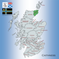
Dosya:Map showing the traditional, geographical county of Caithness, Scotland.png

Bu önizlemenin boyutu: 600 × 600 piksel. Diğer çözünürlükler: 240 × 240 piksel | 480 × 480 piksel | 768 × 768 piksel | 1.024 × 1.024 piksel | 2.048 × 2.048 piksel | 4.967 × 4.967 piksel.
Tam çözünürlük ((4.967 × 4.967 piksel, dosya boyutu: 6,6 MB, MIME tipi: image/png))
Dosya geçmişi
Dosyanın herhangi bir zamandaki hâli için ilgili tarih/saat kısmına tıklayın.
| Tarih/Saat | Küçük resim | Boyutlar | Kullanıcı | Yorum | |
|---|---|---|---|---|---|
| güncel | 22.02, 20 Nisan 2024 |  | 4.967 × 4.967 (6,6 MB) | RealCounties | Uploaded own work with UploadWizard |
Dosya kullanımı
Bu görüntü dosyasına bağlantısı olan sayfalar: