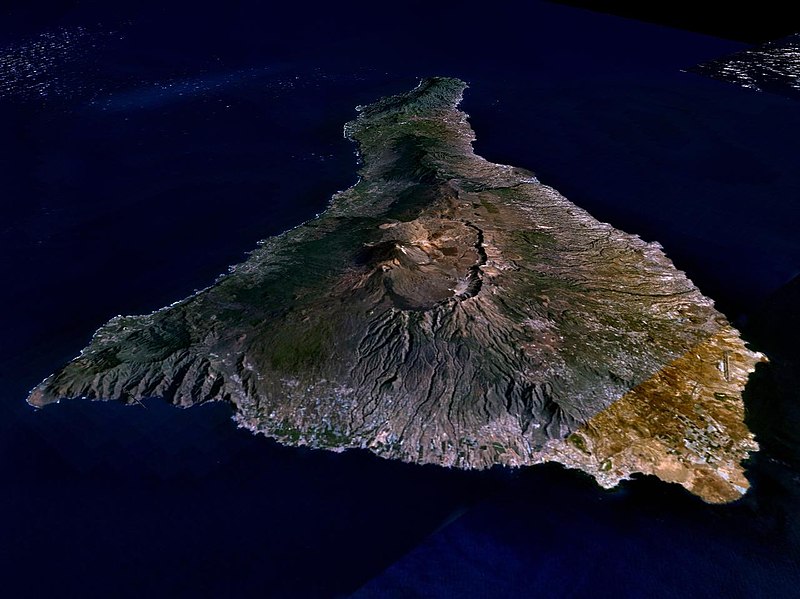
Dosya:Nasa world wind - teneriffa.jpg

Bu önizlemenin boyutu: 800 × 599 piksel. Diğer çözünürlükler: 320 × 240 piksel | 640 × 479 piksel | 1.024 × 766 piksel | 1.280 × 958 piksel.
Tam çözünürlük ((1.280 × 958 piksel, dosya boyutu: 120 KB, MIME tipi: image/jpeg))
Dosya geçmişi
Dosyanın herhangi bir zamandaki hâli için ilgili tarih/saat kısmına tıklayın.
| Tarih/Saat | Küçük resim | Boyutlar | Kullanıcı | Yorum | |
|---|---|---|---|---|---|
| güncel | 01.15, 31 Mart 2005 |  | 1.280 × 958 (120 KB) | Simplicius | {{NASA-PD}} Teneriffa from the west side. One sees Teide (3,700 meters) and the Caldera (2,000 m). To the right hand the new airport. On the left side one sees that there is more humidity and therefore vegetation at the north side of the island. |
Dosya kullanımı
Bu görüntü dosyasına bağlantısı olan sayfalar:
Küresel dosya kullanımı
Aşağıdaki diğer vikiler bu dosyayı kullanır:
- ar.wikipedia.org üzerinde kullanımı
- be-tarask.wikipedia.org üzerinde kullanımı
- cs.wikipedia.org üzerinde kullanımı
- de.wikipedia.org üzerinde kullanımı
- de.wikinews.org üzerinde kullanımı
- de.wikivoyage.org üzerinde kullanımı
- en.wiktionary.org üzerinde kullanımı
- eo.wikipedia.org üzerinde kullanımı
- es.wikipedia.org üzerinde kullanımı
- fa.wikipedia.org üzerinde kullanımı
- fi.wikipedia.org üzerinde kullanımı
- frr.wikipedia.org üzerinde kullanımı
- fy.wikipedia.org üzerinde kullanımı
- gl.wikipedia.org üzerinde kullanımı
- he.wikipedia.org üzerinde kullanımı
- hu.wikipedia.org üzerinde kullanımı
- it.wikipedia.org üzerinde kullanımı
- lt.wiktionary.org üzerinde kullanımı
- mn.wikipedia.org üzerinde kullanımı
- nn.wikipedia.org üzerinde kullanımı
- no.wikipedia.org üzerinde kullanımı
- pl.wiktionary.org üzerinde kullanımı
- ru.wikipedia.org üzerinde kullanımı
- sh.wikipedia.org üzerinde kullanımı
- sk.wikipedia.org üzerinde kullanımı
- sw.wikipedia.org üzerinde kullanımı
- uk.wikipedia.org üzerinde kullanımı
- vi.wikivoyage.org üzerinde kullanımı
- zgh.wikipedia.org üzerinde kullanımı
