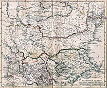
Dosya:Post Roman Balkans.jpg

Bu önizlemenin boyutu: 729 × 600 piksel. Diğer çözünürlükler: 292 × 240 piksel | 583 × 480 piksel | 933 × 768 piksel | 1.245 × 1.024 piksel | 2.038 × 1.677 piksel.
Tam çözünürlük ((2.038 × 1.677 piksel, dosya boyutu: 721 KB, MIME tipi: image/jpeg))
Dosya geçmişi
Dosyanın herhangi bir zamandaki hâli için ilgili tarih/saat kısmına tıklayın.
| Tarih/Saat | Küçük resim | Boyutlar | Kullanıcı | Yorum | |
|---|---|---|---|---|---|
| güncel | 18.49, 28 Ocak 2010 |  | 2.038 × 1.677 (721 KB) | WikiEditor2004 | Reverted to version as of 01:28, 27 March 2005 - restored original version which has more historical value. please upload your whitened version as a new separate file, not over this one, thank you |
| 10.02, 17 Mayıs 2009 |  | 2.038 × 1.677 (1,1 MB) | Alex:D | whitened | |
| 01.28, 27 Mart 2005 |  | 2.038 × 1.677 (721 KB) | Karmosin~commonswiki | Classical Balkans: from ''Map from "rothers Publishers, New York, 1849A Classical Atlas to Illustrate Ancient Geography,'' Alexander G. Findlay, Harper and B ros. NY 1849 {{PD-art}} category:History of the Balkans |
Dosya kullanımı
Bu görüntü dosyasına bağlantısı olan sayfalar:
Küresel dosya kullanımı
Aşağıdaki diğer vikiler bu dosyayı kullanır:
- ar.wikipedia.org üzerinde kullanımı
- arz.wikipedia.org üzerinde kullanımı
- azb.wikipedia.org üzerinde kullanımı
- az.wikipedia.org üzerinde kullanımı
- ba.wikipedia.org üzerinde kullanımı
- be-tarask.wikipedia.org üzerinde kullanımı
- be.wikipedia.org üzerinde kullanımı
- bg.wikipedia.org üzerinde kullanımı
- ca.wikipedia.org üzerinde kullanımı
- cs.wikipedia.org üzerinde kullanımı
- en.wikipedia.org üzerinde kullanımı
- eo.wikipedia.org üzerinde kullanımı
- es.wikipedia.org üzerinde kullanımı
- gl.wikipedia.org üzerinde kullanımı
- he.wikipedia.org üzerinde kullanımı
- hr.wikipedia.org üzerinde kullanımı
- hy.wikipedia.org üzerinde kullanımı
- it.wikipedia.org üzerinde kullanımı
- ja.wikipedia.org üzerinde kullanımı
- mk.wikipedia.org üzerinde kullanımı
- nl.wikipedia.org üzerinde kullanımı
- pt.wikipedia.org üzerinde kullanımı
- ro.wikipedia.org üzerinde kullanımı
- ru.wikipedia.org üzerinde kullanımı
- sv.wikipedia.org üzerinde kullanımı
Bu dosyanın daha fazla küresel kullanımını görüntüle.


